GPS Map Camera Geotag Location: An Essential Tool for Precise Location Tagging
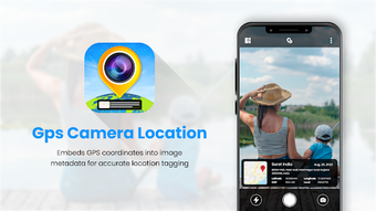
GPS Map Camera Geotag Location is a powerful app that allows users to capture photos with precise location details. Developed by GrowUp Infotech, this app is a must-have for anyone who wants to keep track of addresses and locations on their photos. With GPS Map Camera Geotag Location, users can enhance their photography experience by adding accurate location tags to their images.
The app provides users with a variety of tag templates to choose from, allowing them to customize their photos with the best tags. Additionally, GPS Map Camera Geotag Location offers accurate GPS navigation and turn-by-turn directions, making it easy for users to find their way around.
One of the standout features of GPS Map Camera Geotag Location is its ability to provide map data, allowing users to find the exact location where a photo was taken. This includes latitude, longitude, address, city, state, and country details.
With its clear UI design and easy-to-use interface, GPS Map Camera Geotag Location is an essential tool for anyone who wants to document their journeys and create lasting memories. Download this free app today and enhance your photography with precise location tagging.
